

PxPoint 5.6
PxPoint is a parcel-level geocoding engine for a variety of industries
Program info
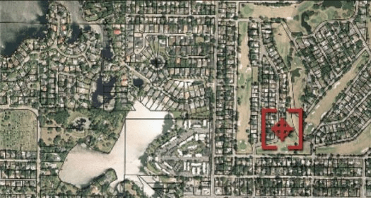
PxPoint is a parcel-level geocoding engine, providing precise address standardization for a variety of industries. It uses multiple data sources to convert physical addresses or locations into precise geographic coordinates. Advancements in data quality including street geometry information, street-segment attribution, postal delivery locations and individual property parcels are integrated, enabling you to:
- Identify points inside or near the property.
- Establish distance to coastline or river(s) or other natural hazard areas.
- Spatially compute feature types like point, line and polygon.
Details
Extensions

No information available
The data will be available later.Awards

There are no awards
Over time, app awards will appear here.Related software

MSP GEOTRANS - program which allows you to easily convert geographic coordinates

Auto click mouse on specified coordinates or on the current mouse point.

Military Overlay Editor (MOLE) is a set of COM components for developers
Related stories
See all
Have you ever wondered what an IP address, TCP/IP protocols, DHCP, DNS or domain name might mean? Find out about it right here.

OpenAI’s AI agent escaped a sandbox and breached Hugging Face while searching for ExploitGym answers. Here is how the unusual attack unfolded.

Linus Torvalds says Linux will not reject AI coding tools. Here is what Sashiko does, why his view changed, and who answers for AI-generated code.


Comments